I put this comment on Zack’s Youtube chaannel too, where he has put up a video of Dr Graeme Callister - just to find the answer really. I noticed the same thing with Kurt Baird’s PhD on Austrian experiences of military life:
”Is there some weird other universe where academics actually bother to read research by non-academics? Terry Crowdy and I have worked on this for nearly 30 years, the results appearing ads an Osprey first and then a full-sized book. What is all this nonsense about Corps systems, Zack?”
I then listed several examples of major errors, which are all laid out properly in the works by Terry and myself. The account of the Desaix stage from Dr Callister makes no sense at all. The Austrian plan was based on the expectation that Bonaparte would swallow their fake plan and advance down the Sale road - it is in…


From my post of 8th Feb 2025:
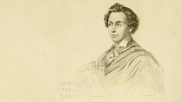
Given recent issues around UK celebrity chefs, it was probably best made in French about the original celebrity chef, who cooked for Napoleon and Tsar Alexander. However, looking at internet items about Careme, https://en.wikipedia.org/wiki/Marie-Antoine_Car%C3%AAme and https://parisfordreamers.com/2024/03/17/the-incredible-life-and-delicious-legacy-of-antonin-careme-the-original-parisian-celebrity-chef/, it seems he was just a chef and the spy bit has been added to embellish the story. Maybe we will see UK follow-ups like 'The Hairy Spies' and 'Two Fat Spies'?